
powered by
- SJV Gateway |
- Maps |
- Agriculture in the San Joaquin Valley
Agriculture in the San Joaquin Valley
Feb 22, 2017
(Last modified Sep 27, 2018)
Created by
Conservation Biology Institute
Featured by Conservation Biology Institute
- Description
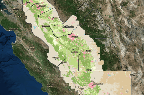
- This map depicts the current state of agricultural in the San Joaquin Valley by showing the designated classes from the 2014 update to the Department of Conservation's FMMP dataset along with 2016 update to the USDA Cropland Data Layer showing the crop type across the San Joaquin Valley.
- Location

- Credits
- Dustin Pearce
- Use Constraints
 This work is licensed under a Creative Commons Attribution 3.0 License.
This map is visible to everyone
Bookmarked by
2 Members
About the Map Author
Conservation Biology Institute
We provide advanced conservation science, technology, and planning to empower our partners in solving the world’s critical ecological challenges