
powered by
- SJV Gateway |
- About San Joaquin Valley Greenprint
About San Joaquin Valley Greenprint
(photo credit: Michael Patrick)
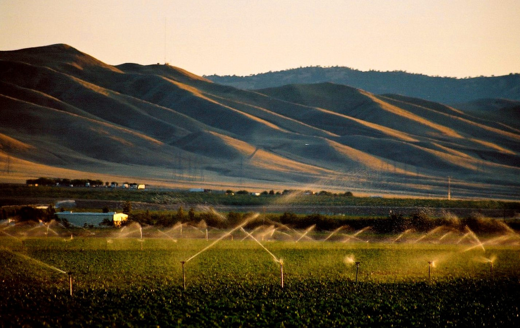
The San Joaquin Valley (SJV) of California is one of the world’s most productive agricultural regions. The SJV provides important habitat for biodiversity and serves as a vital link in complex water and transportation systems. The SJV Greenprint was created as a voluntary, stakeholder-driven project to help the eight counties of the San Joaquin Valley create long-term environmental and economic sustainability in the face of growth, development patterns, and climate challenges.
Phase 1 of the SJV Greenprint involved collecting avialable data and summarizing issues in challenges in the SJV Greenprint State of the Valley Report (Thorne et. al. 2014). This report and the data are a resource that can inform land use and resource management decisions in the Valley, emphasizing the importance of crafting regional solutions because economic and environmental challenges and decisions cross jurisdictional boundaries.
The SJV Greenprint report and products can be used by Valley planners and decision-makers; local, state, and federal resource managers; and the general public to address a range of questions and inform projects, plans, partnerships, and policies that accommodate regional growth while safeguarding the natural resources required to support growth and enhance quality of life throughout the Valley.
A large collection of publicly funded maps and data that portray the SJV’s water, agricultural, energy, and ecological resources have been compiled and uploaded to the San Joaquin Valley Gateway. The maps and data collection span the full extent of the eight San Joaquin Valley counties - Kern, Tulare, Kings, Fresno, Madera, Merced, Stanislaus, and San Joaquin Counties.
The land use challenges facing the eight counties of San Joaquin Valley are significant, with few easy solutions. Water will continue to be a limiting resource, with tensions among urban, agricultural, and environmental uses. Agricultural and natural lands will continue to face conversation pressures as Valley planners and stakeholders weigh the costs and benefits of various land use choices. Economic growth and elevating the region’s quality of life will also continue to be leading topics of discussion.

Phase 2 of the SJV Greenprint included uploading the data collected as part of Phase 1 to the San Joaquin Valley Gateway site. The Greenprint data is organized into a series of galleries, that can can be accessed here: San Joaquin Valley Greenprint
Also as part of Phase 2 of the Greenprint project, three pilot projects are underway to demonstrate the application of these datasets and create tools to support stakeholders. These projects include:
Better Understand the Land-Water Interface in the SJV in Order to Inform Choices about their Use and Management: The American Farmland Trust is partnering with the Conservation Biology Institute to collect and analyze data on: (1) the capacity and uses of the SJV’s principal sources of surface and groundwater; (2) the productivity, versatility and resiliency of agricultural land; and, (3) how land and water resources for agricultural production are likely to undergo change in response to the expansion of urban areas, to evolving environmental needs and to climate change. The analysis will be used to highlight spatially where and to what extent agricultural and urban land uses are and would be vulnerable to depletion of land and water resources under different assumptions about future land and water use scenarios. Read more here: Exploring the Land-Water Intersection in the San Joaquin Valley
Groundwater Recharge Planning Tool: Sustainable Conservation will be developing a geospatial decision support tool that enables irrigation districts and Groundwater Sustainability Agencies (GSA) to identify and prioritize potential on-farm recharge as part of a portfolio of groundwater replenishment options to include in GSAs to achieve sustainable groundwater supplies. Read more here: A Groundwater Recharge Assessment Tool (GRAT) to support planning for cost-effective aquifer recharge
Watershed Enhancement Strategies for Groundwater Sustainability: The Sequoia Riverlands Trust project is working to: (1) Mapping natural resources, land management categories and conservation values along riparian corridors, including creation of a well-documented gallery on San Joaquin Valley Gateway; (2) Developing an interactive, web-based tool that stakeholders can use to identify priority areas for watershed conservation and enhancement; (3) Identifying key elements, partners and potential funding sources for at least one follow-up collaborative project that will significantly enhance natural watershed function and groundwater sustainability; and, (4) prepare a set of policy and strategy recommendations for the region’s first Groundwater Sustainability Plans. Guide and Case Study Coming soon...